Public facilities, clear for your residents
Local authorities and district organisations manage dozens of kinds of facility — recycling points, playgrounds, charging points, community centres — that residents need to be able to find.
Ideal for: Recycling & waste pointsPlaygroundsCharging pointsCommunity centresSports facilities
Short answer
- A facilities map puts every public facility in your area on one mobile-friendly map, where residents filter by type.
- Existing open data or your own list imports in one go; nothing has to be retyped.
- Residents find the nearest point straight away, without downloading a PDF or clicking through several systems.
- Embed the map on the council website, or share it as a standalone link.
- Everything is hosted in Europe and GDPR-compliant; free to start.
What that looks like
A real municipal dataset
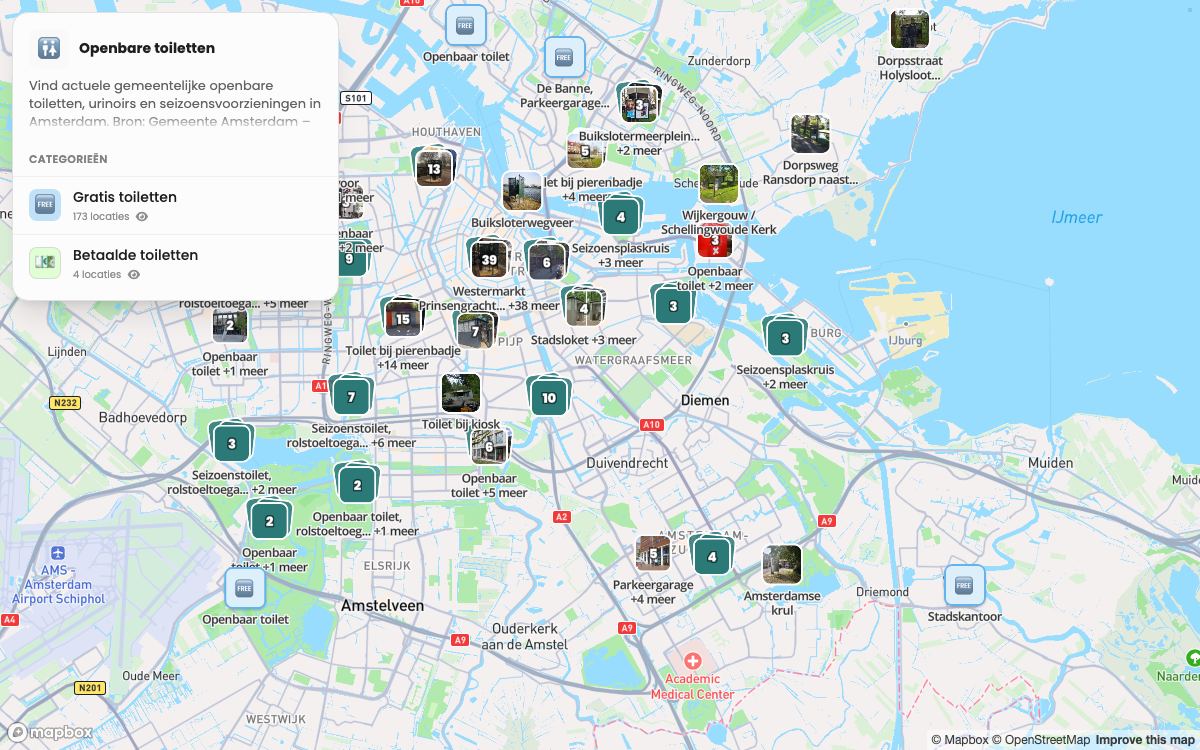
Next to this is the map we built from the City of Amsterdam's open data — the same import, the same steps. Click into it: it is the real, published map.
- 177 facilities from the City of Amsterdam's open data.
- Two categories residents filter on: 173 free and 4 paid.
- Seasonal toilets and wheelchair-accessible units are named as such.
- One map the council can embed on its own site.
What you get
Once you build a facilities map in localthings, this comes with it as standard:
CSV and JSON import
Add a complete dataset in one go.
Category and date filters
Filter by topic, or by today, this weekend or this month.
Embed on your own website
Place the interactive map as an iframe in a page or an article.
yourwebsite.com/map
Also useful: import an existing dataset · embed the map on the council website